New Year’s Day weather forecast – The two most likely scenarios
Διαβάζεται σε 3'
Cold spell or wintry conditions? The two scenarios for New Year’s Day weather, according to meteorologist Thodoris Kolydas.
- 27 Δεκεμβρίου 2025 17:06
With the countdown to the end of the year under way, the weather on New Year’s Eve and New Year’s Day remains a “mystery”, as forecast models continue to diverge in their predictions.
As meteorologist Thodoris Kolydas also notes in a related post, it is still unclear “whether we will see simply wintry conditions or ultimately a more dynamic, wintry interlude”, outlining the two most likely scenarios.
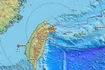
Specifically, according to the ECMWF and ICON models, temperatures will be wintry but without a pronounced cold outbreak or widespread snowfall at low altitudes. These models “converge on a milder and more ‘contained’ scenario for the turn of the year”, in which weather phenomena are limited and mainly affect the eastern and southeastern Aegean.
On the other hand, the GFS model “continues to favour a heavier scenario, with a deeper southward movement of cold air masses towards the Balkans and Greece”, Mr Kolydas explains. “Under this version, conditions would favour more widespread snowfall, lower temperatures at the 850 hPa level, and a longer-lasting cold spell, especially in the northern and eastern parts of the country.”
In any case, according to the Hellenic National Meteorological Service (EMY), low temperatures, frost and snowfall in certain areas of the country are expected both on New Year’s Eve (31/12) and on New Year’s Day (1/1).
Thodoris Kolydas’ post:
“ASSESSMENTS AND COMPARISONS
The ECMWF and ICON models converge on a milder and more ‘contained’ scenario for the turn of the year. Both models keep the main body of the cold air mass further east, with low-pressure systems remaining mainly over the Eastern Mediterranean and Greece lying on the fringe of their influence. Under this solution, weather phenomena are limited, occurring mainly in the eastern and southeastern Aegean, while temperatures are wintry but without a pronounced cold outbreak or widespread snowfall at low altitudes.
By contrast, the GFS continues to favour a heavier scenario, with a deeper southward movement of cold air masses towards the Balkans and Greece. In this version, conditions would favour more widespread snowfall, lower temperatures at the 850 hPa level, and a longer-lasting cold spell, especially in the northern and eastern parts of the country. This is a more aggressive scenario, but also a more isolated one compared with the other two models.
Therefore, at this stage the balance is tipping towards the ECMWF–ICON solution, which appears more consistent and less extreme. The GFS cannot be ignored, but it seems to represent the ‘cold extreme’ of the spectrum, increasing uncertainty without making it the most likely scenario. As often happens around the turn of the year, small shifts in the upper-level dynamical fields will determine whether we experience simply wintry conditions or ultimately a more dynamic, wintry interlude.
We still need another 2–3 days to arrive at a better operational assessment for New Year’s Day. Best wishes.”