Two regions on red alert – Where will the bad weather strike
Διαβάζεται σε 5'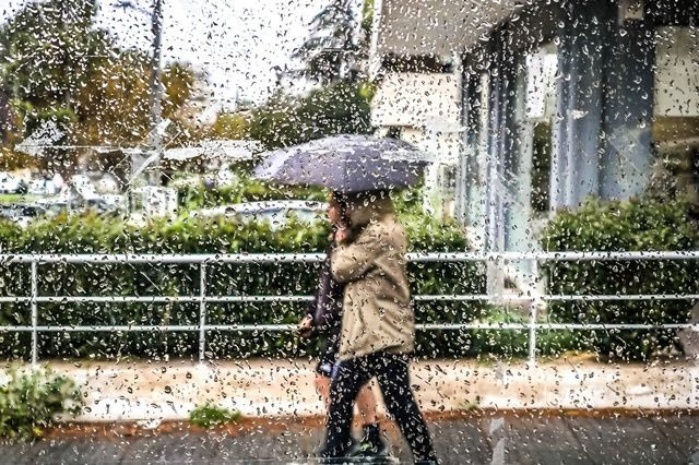
Warning from the National Meteorological Service for two waves of bad weather. What the new emergency weather report says. Instructions from Civil Protection.
- 11 Φεβρουαρίου 2026 14:13
The government machinery is on high alert once again due to the impending 48-hour bad weather.
Specifically, as announced by the Ministry of Climate Crisis and Civil Protection, the General Secretariat for Civil Protection, following the issuance of the Emergency Weather Warning by the National Meteorological Service (EMY), has mobilized the Regional Units of Achaia and Ilia in the Western Greece Region, placing them under “Red Code” status from today until Friday, to address risks from potential flooding events.
Additionally, municipalities and regions are urged to immediately convene the Local Operational Coordinating Bodies (T.E.S.O.P.P.) and Regional Operational Coordinating Bodies (P.E.S.O.P.P.).
It is reminded that earlier, on Wednesday morning (February 11), the National Meteorological Service issued a new emergency weather update, warning of a “double storm” with heavy rains, thunderstorms, and gale-force winds.
Specifically, it is forecast that two consecutive atmospheric disturbances will affect the weather in the country. The first is expected from early this evening, Wednesday (February 11), until the early morning hours of Thursday (February 12), and the second from late Thursday afternoon until the morning hours of Friday (February 13), with heavy rains and thunderstorms and very strong winds.
First wave of bad weather:
Heavy rains and thunderstorms:
- In the Ionian islands from Lefkada southwards, western Peloponnese, and western Sterea from early this evening Wednesday until the early hours of Thursday.
- In Crete, the Cyclades, and eastern Peloponnese during the night from Wednesday to Thursday.
- In Eastern Macedonia and Thrace (mainly in Thassos, Samothrace, and coastal mainland areas) on Thursday until the morning hours.
- In the Dodecanese and the islands of the northern and eastern Aegean on Thursday until the morning hours.
Very strong to gale-force south-southwest winds will blow:
- In western Greece on Wednesday evening and in the southern Aegean (Crete, Cyclades, and Dodecanese) on Thursday until the early morning hours.
Second wave of bad weather:
Heavy rains and thunderstorms:
- In western and southern Peloponnese and Ionian Islands (Zakynthos, Kefalonia, Ithaca) from late Thursday afternoon until the early morning hours of Friday.
- In Crete and the Cyclades during Thursday night to Friday.
- In the Dodecanese and the islands of the northern and eastern Aegean on Friday until the morning hours.
- In Thrace temporarily on Friday morning (February 13).
Very strong to gale-force winds will blow:
In western Greece on Thursday evening (south-southwest winds) and Friday morning (west-northwest winds), and in the southern Aegean (Crete, Cyclades, and Dodecanese) on Friday until noon.
Civil Protection Recommendations:
In areas where heavy rain, thunderstorms, or gale-force winds are expected, the General Secretariat for Civil Protection advises citizens to:
- Secure objects that could be swept away by severe weather, which may cause damage or injuries.
- Ensure that gutters and drains at homes are not blocked and are functioning correctly.
- Avoid crossing streams and torrents on foot or by vehicle during storms and rain, and for several hours afterward. Special caution is needed where roads intersect with torrents and there is no bridge.
- Avoid outdoor activities and sea or coastal areas during severe weather (risk of lightning strikes).
- Seek shelter during hailstorms in a building or car and remain in a safe place until the storm has passed.
- Avoid areas under large trees, hanging signs, or places where light objects (e.g., flowerpots, broken glass, etc.) might fall (e.g., under balconies).
- Follow instructions from local authorities, such as traffic police.
For Thunderstorm Activity:
If you are indoors:
- Avoid using electrical appliances or telephones as lightning can pass through wires.
- Unplug television sets from antennas and electrical outlets.
- Avoid touching plumbing as it conducts electricity.
If you are in a car:
- Pull over to the side of the road and stay away from trees that may fall on the car.
- Stay inside, turn on hazard lights until the storm subsides.
- Keep windows closed and avoid touching metal objects.
- Avoid flooded roads.
If you are outdoors:
- Seek shelter in a building or car, or sit on the ground (do not lie down).
- Protect yourself under solid branches of low trees in the forest.
- Never seek shelter under tall trees in open areas.
- Avoid low-lying areas due to flood risk.
- Do not stand next to power poles, power lines, telephone lines, or fences.
- Keep away from metal objects (e.g., cars, bicycles, camping gear, etc.).
- Stay away from rivers, lakes, or other bodies of water.
- If in the sea, immediately get out.
- If in an open area and feel your hair stand up (a sign of an imminent lightning strike), crouch down with your head between your knees and discard any metal objects.
For updates on the weather and road conditions due to floods or snowfall, visit the Greek Police website or the Civil Protection website for more information.