Emergency weather warning from the Hellenic National Meteorological Service – Which areas will be affected
Διαβάζεται σε 2'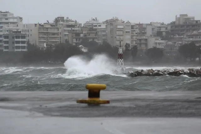
A new deterioration in the weather is expected, with strong thunderstorms and strong winds. Below are the areas expected to be most affected.
- 19 Φεβρουαρίου 2026 13:03
A brief worsening of the weather with heavy rain, thunderstorms, and possibly localized hailstorms is forecasted from the early hours of tomorrow until the afternoon of Saturday (21/2). The bad weather will initially affect the northwest part of the country and gradually spread to the rest of western Greece, northeastern mainland, and the eastern Aegean, according to the Emergency Weather Warning with an orange alert issued by the Hellenic National Meteorological Service (EMY).
Strong southerly winds, with intensities of 7 and locally 8 Beaufort, will blow on Friday (20-02-26), initially in the Ionian Sea and gradually in the central and northern Aegean.
Specific Forecasts:
Friday
- In the northern part of the Ionian (Corfu, Diapontian Islands, Paxos) and in Epirus, from the early hours until early noon.
- In the rest of the Ionian and western Sterea, from the morning until the afternoon.
- In western and southern Peloponnese, from late morning until late afternoon.
- In Eastern Macedonia and Thrace, from the afternoon.
- In the rest of Peloponnese, Eastern Sterea (including Attica), and Evia, briefly from early evening until late at night.
- In the islands of the northeastern Aegean, from early evening.
Saturday
- In Eastern Macedonia, Thrace, and the islands of the northeastern Aegean until the afternoon.
- In the islands of the eastern Aegean until midday.
- In the Dodecanese, from the morning until midday.