Second wave of bad weather begins – The areas The areas hardest hit
Διαβάζεται σε 5'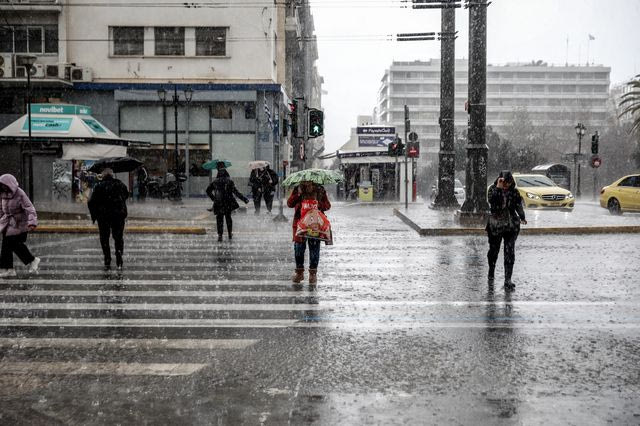
Intense phenomena with thunderstorms and strong winds are expected across the country on Thursday (12/02) and Friday (13/02). Detailed forecast below.
- 12 Φεβρουαρίου 2026 23:14
From late Thursday afternoon (12/02), the second wave of bad weather begins, sweeping across several regions of the country.
Specifically, according to the updated emergency bulletin from the Hellenic National Meteorological Service (EMY) regarding the short spell of severe weather affecting the country,
the second wave will last from Thursday afternoon until the early morning hours of Friday (13/02), bringing heavy rain and thunderstorms as well as very strong winds. More specifically, heavy rain and thunderstorms are forecast:
a. in western and southern Peloponnese and the Ionian islands from Thursday afternoon, 12-02-2026, until the early morning hours of Friday, 13-02-2026
b. in Crete from Thursday evening until Friday morning, 13-02-2026
c. in the Cyclades temporarily during the night from Thursday to Friday
d. in the islands of the northern and eastern Aegean on Friday until the morning hours
e. in the Dodecanese on Friday at intervals until the afternoon
f. in Thrace temporarily on Friday morning, 13-02-2026.
Very strong to gale-force winds will blow:
in western Greece: on Thursday night (southerly to southwesterly winds) and during the morning hours of Friday (westerly to northwesterly winds)
in the regions of Crete, the Cyclades and the Dodecanese during the night from Thursday to Friday (southwesterly winds) and
in the areas of Kythera and Crete on Friday from morning until afternoon (westerly winds).
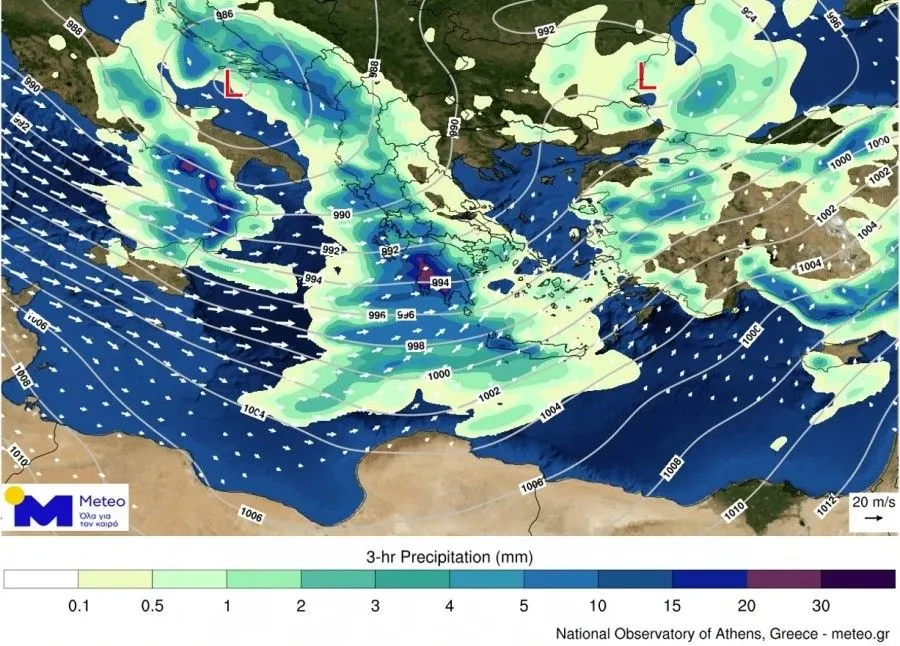
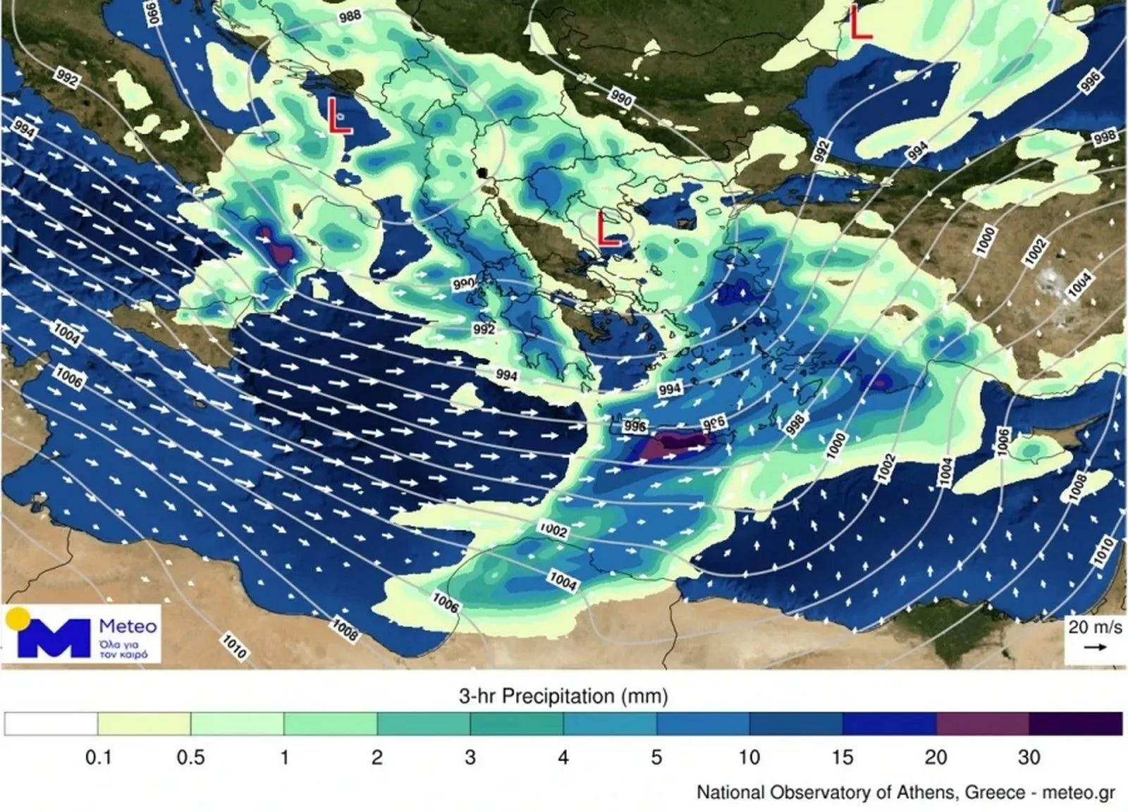
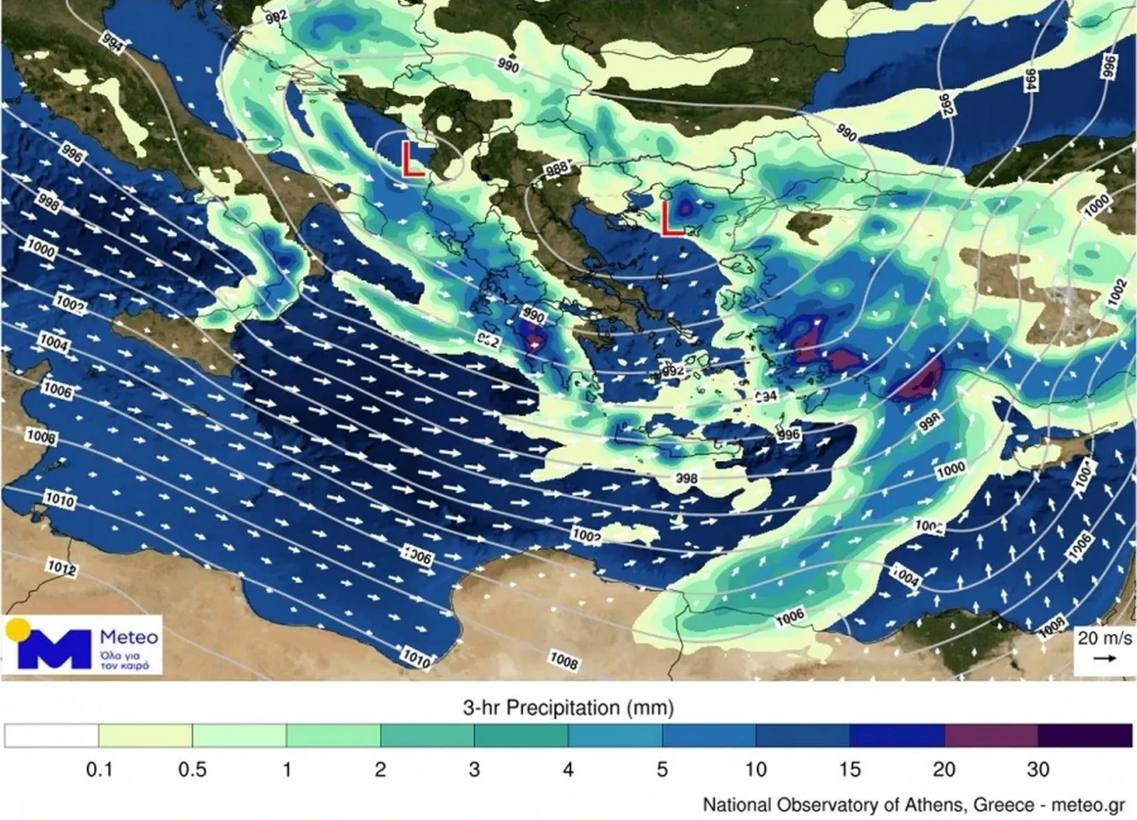
Maps of the phenomena
Between 17:00–20:00 on Thursday 12/02
Between 23:00 on Thursday 12/02 and 02:00 on Friday 13/02
Between 05:00–08:00 on Friday 13/02
FORECAST FOR FRIDAY 13-02-2026
Increased cloud cover with rain and scattered thunderstorms across almost the entire country. Until the morning hours, the phenomena will be intense in western and southern Peloponnese, the Ionian islands of Zakynthos, Kefalonia and Ithaca, in Crete and the Cyclades, the Dodecanese and the islands of the northern and eastern Aegean, as well as in Thrace.
Temporary snowfall will occur in the central and northern mountainous areas.
Winds will blow from the west-northwest at 4 to 6 Beaufort and in the south 7 and locally 8 Beaufort.
Temperatures will not change significantly and will remain at high levels for the season. In the north they will reach 14 to 16°C, in the Ionian and the rest of the mainland 17 to 18°C, and in the eastern island regions 18 to 19°C.
FORECAST FOR SATURDAY 14-02-2026
In the west and gradually in the central and northern regions, cloud cover with rain and thunderstorms. In the evening, the phenomena will extend to the rest of the mainland. In the rest of the country, a few clouds, temporarily increased over the islands of the eastern Aegean and the Dodecanese, where local rain will occur in the morning hours.
Snowfall will occur until midday in the central and northern mountainous areas.
Winds will initially blow from westerly directions at 4 to 6 Beaufort; however, quickly in the west and from midday in the east, southerly winds of 6 to 7 Beaufort will prevail, and at night in the Aegean locally up to 8 Beaufort.
Temperatures will record a slight rise in maximum values.
FORECAST FOR SUNDAY 15-02-2026
Cloud cover with local rain and scattered thunderstorms in the west, central and northern regions, the islands of the northern and eastern Aegean and gradually in the Dodecanese. Weakening of the phenomena in the eastern mainland in the afternoon. In the remaining areas, a few clouds, temporarily increased.
Temporary snowfall will occur in the central and northern mountainous areas.
Meteorological conditions favor the transport of African dust to the central and southern regions.
Winds will blow in the Ionian from the west-southwest at 4 to 6 Beaufort and in the Aegean from southerly directions at 7 to 8 and temporarily locally 9 Beaufort, with slight weakening from the afternoon.
Temperatures will slightly decrease in the west.
FORECAST FOR MONDAY 16-02-2026
Cloud cover with local rain in almost the entire country. Scattered thunderstorms will occur mainly in the west, the north, the islands of the northern and eastern Aegean and the Dodecanese.
Temporary snowfall will occur in the northern mountainous areas.
Meteorological conditions favor the transport of African dust to the central and southern regions.
Winds will blow from the south-southwest at 4 to 6 and locally up to 7 Beaufort, and in the southeastern Aegean temporarily in the morning hours from the southeast at 6 to 7 Beaufort. From midday in the west, they will shift to west-northwest at 4 to 6 Beaufort.