48-hour storm with thunderstorms and winds approaching – How will it affect Athens
Διαβάζεται σε 5'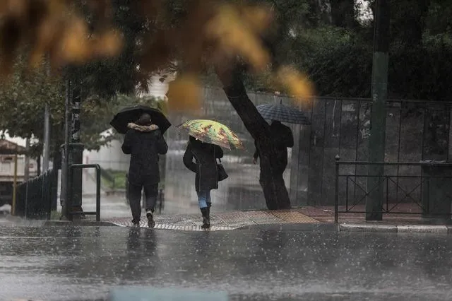
A new weather system will affect the country from Saturday to Monday, with heavy rains, thunderstorms, and strong winds being the main characteristics.
- 30 Ιανουαρίου 2026 18:29
According to meteorologists, a deep low-pressure system will impact the country starting Saturday afternoon, bringing heavy rain and thunderstorms.
Clearchos Marousakis states that the weather phenomena will have intensity, duration, and will be widespread.
Theodoros Kolyda: When will the storm peak in Athens
According to an update from Kolyda, “A deep low-pressure system will affect the country from Saturday afternoon, especially on Sunday until Monday noon, with heavy rain and thunderstorms. In Athens, based on the expected rainfall peak on Sunday, the expected 24-hour rainfall is around 30 mm, with the maximum rainfall reaching 60-65 mm per 24 hours.”
Kolyda’s post: “A deep low-pressure system will impact us from Saturday afternoon, primarily affecting Sunday until Monday noon, with heavy rain and thunderstorms. The system has a distinct spiral structure, with strong low-level convergence, large areas of continuous precipitation, and active interaction with upper disturbances. The possibility of strong phenomena has already been mentioned in the general forecast by the Hellenic Meteorological Service. According to the ENS meteogram for Athens, expected rainfall will peak on Sunday with 30 mm, and the absolute maximum will reach 60–65 mm per 24 hours. Please note that this meteogram refers to one location, and deviations might occur in other regions due to topography or other factors. Stay updated with official announcements.”
Clearchos Marousakis: The country will continue to be in the path of successive weather waves, with the most significant being expected from Saturday afternoon until Monday evening.
Marousakis’ post
NATIONWIDE WINTER-TYPE STORM
The country will continue to experience successive weather waves over the next 24 hours, with the most important one expected from Saturday afternoon until Monday evening. Key points:
A very deep and well-organized low-pressure system will cause this storm. This means that the phenomena will be intense, long-lasting, and widespread.
The large pressure difference will cause stormy and locally very stormy winds over both land and sea. This will lead to high and dangerous waves in our seas.
Phenomena such as hail, waterspouts, heavy rain, and intense lightning activity are likely to occur.
As the storm moves eastward, it will push polar air masses further south, potentially bringing not only a lot of rain but also snow, not just in the mountains.
This is a typical, expected storm for this time of year in our geographical region, so we must exercise caution.
Weather Maps: The storm will affect Sunday morning primarily in the west. By noon, it will cover most of the mainland, and by 18:00, it will hit Macedonia, Thrace, and the islands of the eastern Aegean. On Monday morning, the phenomena will affect the islands of the eastern Aegean, Halkidiki, and northeastern Evia.
Saturday, January 31st Weather
Clouds will temporarily increase in the west with local rains and thunderstorms, particularly in the Ionian. From late evening, the weather will worsen. Elsewhere, there will be intermittent clouds with local rains, and strong thunderstorms may occur on the Aegean islands, especially in the morning. However, by late afternoon, most areas will see the weather improve.
There will be brief snowfalls in the central and northern mountains. Winds will be from the southwest at 4-6 Beaufort in the south, from the northeast at 3-5 Beaufort in the north, and from the southeast in the Ionian at 6 Beaufort by evening. Temperatures will remain stable, ranging from 12-14°C in the north, 15-17°C in the Ionian and most inland areas, and 18-19°C in the southern Aegean.
Sunday, February 1st Weather
Clouds will bring rain and thunderstorms across most of the country. In the west and gradually in Thessaly, central Macedonia, and the eastern Aegean, these phenomena may be strong. The weather will weaken in the west by night.
Snowfall will occur in the mountains of the mainland and, from afternoon, in the northeastern foothills. Winds will be from the east in the north and from the south in the south, 4-6 Beaufort, with strong gusts of 7-8 Beaufort at sea. Temperatures will drop in the central and northern areas.
Monday, February 2nd Weather
Clouds will increase with local rain, and in the eastern islands, there will be sporadic thunderstorms in the morning. Snow will fall in the central and northern mountains, as well as the foothills of the northeastern country.
By afternoon, the weather will improve in the west. Winds will be north-northwest, 4-5 Beaufort in the west, temporarily reaching 6 Beaufort, and 5-7 Beaufort in the east, with gusts reaching 8 Beaufort at sea. Temperatures will fall slightly, especially in the east.