Heatwave: The “thermal dome” moves toward the Balkans – The forecast for Greece
Διαβάζεται σε 9'
The “thermal dome” that is making Europe “boil” moves over the Balkans. Which countries have issued warnings for extreme heat in the coming days. The forecast for Greece.
- 30 Ιουνίου 2026 12:20
Parts of central, eastern and southern Europe “boiled” on Monday (29/6), as the “thermal dome” that caused last week’s record temperatures shifted eastward, bringing the heatwave to countries in Central Europe as well as large parts of the Balkans.
Budapest is expected to exceed 40°C on Tuesday, according to models from the European Centre for Medium-Range Weather Forecasts.
Belgrade and Bucharest reached 38°C and 37°C respectively on Monday, as the deadly heatwave moved eastward. Slovakia recorded a new temperature record, reaching 40.5°C in a town near its southern border, surpassing the previous record of 40.3°C set in 2007.
“The two most difficult days of the heatwave are coming. Let us show that we are capable of full national unity. Let us look out for one another,” Hungarian Prime Minister Péter Magyar wrote on X on Monday.
Hungarian authorities published a list of more than 2,000 air-conditioned centres across the country for people who cannot find relief from the heat at home.
Hungary’s energy minister granted a temporary exemption to the Paks nuclear power plant from cooling water temperature rules, in order to avoid a further significant reduction in energy production amid the heatwave, according to the plant’s operator.
Extreme heat warnings across multiple countries
Red alerts for extreme heat have been issued in several countries: Hungary, Poland, Romania, Serbia, Croatia, Slovakia and Bosnia and Herzegovina — with authorities urging citizens to remain indoors during the hottest hours of the day.
Germany recorded its highest temperature for the third consecutive day on Sunday, with preliminary data from the DWD meteorological service showing 41.7°C in Coschen, Brandenburg. The extreme heat caused transport disruptions in several cities, as tram lines warped, while Berlin police used water cannons to cool crowds in public spaces.

In Croatia, the meteorological service issued a red alert on Monday for areas including the capital Zagreb and the tourist destinations of Split and Dubrovnik.
Dozens of firefighters, supported by four aircraft, were battling a forest fire in a pine woodland on the tourist island of Vis in the Adriatic, about 55 km southwest of Split.
The worst part of the heatwave has, however, begun to ease in Western Europe. In France, authorities reported that the heatwave contributed to more than 1,000 additional deaths, while Spain’s public health institute recorded more than 800 excess deaths nationwide.
Storms after the heatwave
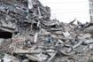
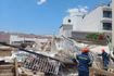
In some regions, extreme weather conditions were followed by severe storms. In Italy’s Alto Adige region, torrential rain caused flash floods and landslides, with up to 50 mm of rain falling in one hour in some areas. Many residents were evacuated from their homes, while firefighters rescued a person trapped in a garage after a river overflowed near the city of Merano.
The heatwave sweeping across Europe, the most severe and widespread to date, is attributed to the climate crisis driven by the burning of fossil fuels, according to scientists.
Deaths were also reported across Europe over the weekend. Two cyclists, aged 30 and 71, died, likely due to heat, during a cycling race near Warsaw on Sunday. At least 13 people died in Germany over the weekend, according to police.

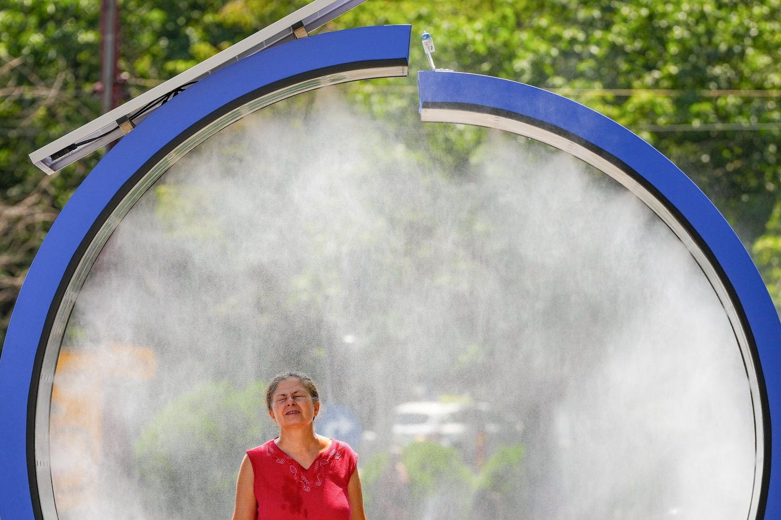
Youngsters walk by a water mist machine installed by city administration to assist people in coping with the heat on a torrid day, as the National Weather forecaster issued an extreme heat code red warning for most parts of the country, in Bucharest, Romania, Monday, June 29, 2026. (AP Photo/Vadim Ghirda)The use of air conditioning across large parts of Central and Eastern Europe remains very low compared with the European average of around 19%, according to the International Energy Agency. In Ukraine, the damaged energy grid was preparing for a sharp increase in electricity demand due to rising temperatures. Power outages were reported in several regions, according to local authorities and energy providers.
The state meteorological centre forecast temperatures of 35°C to 38°C on Monday, warning of “intense heat”.
“Heat is also a serious test for equipment operating under wartime conditions for more than four years and which has withstood multiple attacks,” said the chief executive of the energy company Yasno, Serhii Kovalenko, over the weekend. “In the coming days, the energy system will come under very heavy pressure.”
Grid operators in at least five regions — from Ivano-Frankivsk in the west to Zaporizhzhia on the southern frontline — announced that temporary restrictions on energy use would be imposed during Tuesday.
Forecast for Greece
On Monday (29/6), high temperatures were recorded in Western and Northern Greece.
According to Meteo, Orestiada recorded a maximum temperature of 37.7°C, followed by Olenia in Achaia and Dion in Pieria at 37.4°C.
For today, Tuesday (30/6), mostly fair weather is expected across most of the country, with temporary cloud cover during the midday and afternoon hours over the mainland and local showers. In particular, isolated thunderstorms are expected in Epirus, Western and Central Macedonia, and in the mountainous areas of Western Central Greece and Western Peloponnese.
Winds will blow from northerly directions at 3 to 5 Beaufort, and locally up to 6 Beaufort in the Aegean.
Temperatures will not change significantly. They will reach 30–32°C in the northern Aegean and the Cyclades, 34–36°C in most other areas, and locally up to 37°C in inland regions.
MACEDONIA – THRACE
Weather: Generally fair in Thrace with temporary cloud cover during midday and afternoon hours. In Macedonia, clouds will increase during the afternoon with local showers and, mainly in Western and Central Macedonia, isolated thunderstorms. By night, phenomena will gradually cease.
Winds: Northerly 3–5 Beaufort.
Temperature: 20–36°C, locally up to 37°C in Central Macedonia. Western Macedonia 2–3°C lower.
IONIAN ISLANDS – EPIRUS – WESTERN GREECE – WESTERN PELOPONNESE
Weather: Generally fair with temporary clouds during midday and afternoon, bringing local showers mainly inland and isolated thunderstorms in Epirus and mountainous areas of Western Central Greece and Western Peloponnese.
Winds: Northerly 3–5 Beaufort.
Temperature: 22–36°C. Inland Epirus 2–3°C lower.
THESSALY – EASTERN STEREA – EVIA – EASTERN PELOPONNESE
Weather: Generally fair with temporary clouds initially in Thessaly and during midday and afternoon in mountainous areas of Central Greece and Eastern Peloponnese, where local showers will occur.
Winds: Northerly, and in the south westerly, 4–5 Beaufort, locally up to 6 Beaufort in eastern areas until the afternoon.
Temperature: 22–36°C, locally up to 37°C inland.
CYCLADES – CRETE
Weather: Fair. Temporary clouds during midday and afternoon in mountainous Crete.
Winds: Northerly in the Cyclades and westerly in Crete, 4–6 Beaufort.
Temperature: 24–32°C, up to 34°C in southern Crete.
EASTERN AEGEAN ISLANDS – DODECANESE
Weather: Generally fair.
Winds: Northerly 4–5, locally up to 6 Beaufort.
Temperature: 23–35°C.
ATTICA
Weather: Generally fair.
Winds: Northerly-northeasterly 4–5, locally up to 6 Beaufort in eastern areas, gradually weakening.
Temperature: 24–36°C, 2–3°C lower in eastern areas.
THESSALONIKI
Weather: Generally fair with temporary clouds in the afternoon and local showers, possibly isolated thunderstorms in surrounding mountains.
Winds: Variable 3 Beaufort, becoming northwesterly 4–5 Beaufort at night.
Temperature: 22–36°C.
Weather for Wednesday 01/07
Generally fair weather. Temporary clouds in the afternoon over mainland areas with local showers and isolated thunderstorms in the northwest. Winds from northerly directions 3–5 Beaufort, locally up to 6 in the Aegean.
Temperatures will remain stable, reaching 30–33°C in the Cyclades and northern Crete, 34–36°C elsewhere, and locally up to 37°C inland.
Weather for Thursday 02/07
Generally fair weather. In the afternoon, temporary cloud development over mainland areas with local showers and isolated thunderstorms, mainly in central and northern mountainous regions. Winds northwesterly 3–5 Beaufort, locally up to 6 in southeastern areas. Temperatures will remain stable.
Weather for Friday 03/07
In the north, locally increased clouds with local rain and isolated thunderstorms mainly in the afternoon. Elsewhere, generally fair with temporary clouds over mainland areas, where local showers and mountain thunderstorms will occur.
Winds northwesterly 3–5 Beaufort, locally up to 6 in southeastern seas. Temperatures will slightly drop in the north.
Weather for Saturday 04/07
In eastern and southern island regions, generally fair weather. Elsewhere, locally increased cloud cover with showers and isolated thunderstorms, mainly in the afternoon over mainland areas.
Winds northwesterly 3–5 Beaufort, locally up to 6 in seas. Temperatures will slightly decrease across the country.