Greece faces heat, Saharan dust and gale-force winds
Διαβάζεται σε 5'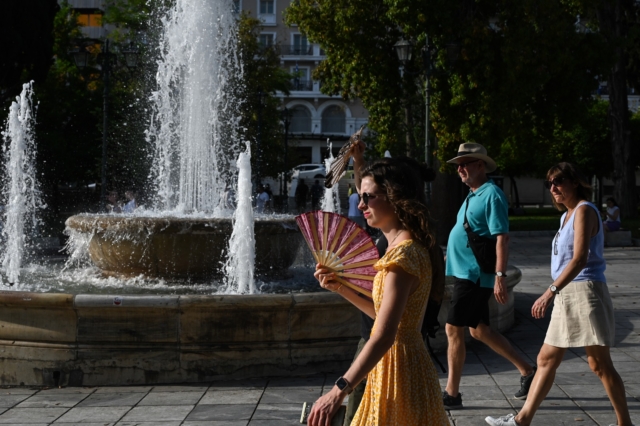
High temperatures will persist across the country on Wednesday, while Saharan dust gradually subsides and northerly winds reach up to 8 Beaufort in the Aegean.
- 29 Ιουλίου 2026 09:26
High temperatures will persist across Greece on Wednesday, July 29, while the northerly summer winds known as the meltemi are expected to strengthen.
At the same time, the latest episode of Saharan dust transport will continue before gradually easing.
The dust event, which began on Monday, July 27, is expected to last through Wednesday. According to AtmoHub, Greece’s information hub for atmospheric composition, the dust will be most noticeable in the upper layers of the atmosphere, with lower concentrations also expected near ground level.
AtmoHub said atmospheric conditions over the eastern Mediterranean are favoring the movement of air masses carrying increased concentrations of desert dust from North Africa towards Greece.
People belonging to vulnerable groups are advised to monitor the development of the phenomenon, particularly in areas where locally elevated particle concentrations are recorded.
Weather forecast for Wednesday
The weather will be generally clear, with temporary cloud developing over mainland areas during the afternoon.
Local rain or showers are possible, mainly over mountainous areas in central and northern Greece.
Winds will blow from the east at 3 to 5 Beaufort in western regions. In the east, northerly and northeasterly winds will reach 5 to 7 Beaufort, possibly rising locally to 8 Beaufort in the Aegean.
Temperatures will fall slightly in eastern Greece.
Maximum temperatures are forecast to reach:
- 34–35°C in the Ionian, the southeastern Aegean and southern Crete.
- 36–37°C across mainland Greece.
- 30–32°C across the rest of the islands.
Macedonia and Thrace
The weather will remain mostly clear, with temporary afternoon cloud over mountainous areas.
Local showers are possible, mainly over the mountains of western Macedonia.
Winds will blow from the east and northeast at 3 to 5 Beaufort, reaching locally 6 Beaufort in eastern areas. From midday, southeasterly winds of 3 to 4 Beaufort are expected in western areas.
Temperatures will range from 20°C to 33–34°C, with western Macedonia three to four degrees cooler.
Ionian Islands, Epirus and western Greece
Conditions will be mostly sunny, with temporary cloud over mainland mountain areas during the afternoon.
Local showers are possible, particularly over the mountains of Epirus.
Winds will initially blow from the southeast at 3 to 4 Beaufort, turning westerly and northwesterly at 4 to 5 Beaufort from the afternoon.
Temperatures will range from 21°C to 35°C, reaching locally 36–37°C on the mainland. Inland Epirus will be three to four degrees cooler.
Thessaly, eastern Central Greece and the eastern Peloponnese
The weather will remain mostly sunny, with temporary afternoon cloud over mainland mountain areas, where local rain or showers may develop.
Winds will blow from the east at 3 to 5 Beaufort, becoming northerly and northeasterly at 5 to 6 Beaufort in eastern areas and locally reaching 7 Beaufort.
Temperatures will range from 20°C to 36–37°C.
Cyclades and Crete
The weather will be generally clear.
Northerly winds will reach 6 to 7 Beaufort and locally 8 Beaufort.
Temperatures will range from 23°C to 30°C, rising locally to 33–34°C in southern Crete.
Eastern Aegean islands and Dodecanese
Conditions will remain generally sunny.
Northerly winds will blow at 6 to 7 Beaufort, reaching locally 8 Beaufort.
Temperatures will range from 22°C to 31–32°C, rising to 34–35°C in southern areas.
Attica
The weather in Attica will remain generally clear.
Northerly winds will blow at 4 to 5 Beaufort, strengthening to 6 and gradually 7 Beaufort in eastern districts.
Temperatures will range from 23°C to 36°C.
Thessaloniki
Thessaloniki will remain mostly sunny, with temporary afternoon cloud over the surrounding mountains.
Southeasterly winds will blow at 3 to 4 Beaufort.
Temperatures will range from 22°C to 33°C.
Forecast for Thursday
Thursday will be generally clear, with temporary afternoon cloud over northern mountain areas.
Northerly winds will blow at 4 to 6 Beaufort, reaching 7 to 8 Beaufort in the Aegean.
Temperatures are not expected to change significantly.
Forecast for Friday
The weather will remain mostly sunny, with temporary cloud over eastern regions and Crete.
Local rain or showers are possible, mainly over mountainous areas.
Northerly and northeasterly winds will reach 5 to 7 Beaufort, rising locally to 8 Beaufort in the Aegean.
Temperatures will remain largely unchanged.
Forecast for Saturday
Saturday will be generally clear, with temporary cloud over eastern regions and Crete.
Local rain or showers may develop, mainly over mountainous areas.
Northeasterly winds will blow at 4 to 6 Beaufort, reaching locally 7 Beaufort in the Aegean.
No significant change in temperature is expected.