Two-day spell of severe weather with thunderstorms, hail and dust – Where it will hit
Διαβάζεται σε 8'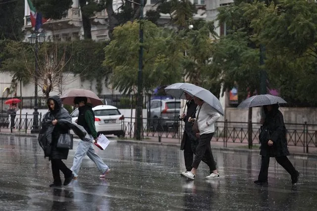
A temporary deterioration in the weather with heavy rain, thunderstorms and possibly localised hailstorms is forecast from the early hours of Friday until Saturday afternoon. Detailed forecast by the Hellenic National Meteorological Service (EMY).
- 20 Φεβρουαρίου 2026 08:27
A significant change in the weather is expected today, Friday (20/2), until Saturday afternoon (21/2), with the passage of an organised cold front from west to east. The system will bring widespread rain and thunderstorms, as well as strengthening winds in many parts of the country.
During the morning hours of Friday, rain and thunderstorms will mainly affect the Ionian islands, Epirus and western Greece in general, while the rest of the country will see increased cloud cover with local showers.
From midday and especially in the afternoon, the phenomena will extend to most mainland areas, as well as the islands of the northern and central Aegean.
In the Peloponnese, particularly in coastal areas, thunderstorms may be strong and locally accompanied by gale-force wind gusts, hail and an increased likelihood of waterspouts.
In Attica, rainfall is expected mainly in the afternoon, with strong southerly winds.
The transport of dust from Africa will also favour muddy rain in southern Greece, including Attica.
Improvement in the weather over the mainland is forecast from Friday evening, except for eastern Macedonia and Thrace, where rainfall will persist until Saturday morning (21/2). By contrast, on the Aegean islands and in Crete, at times heavy rain and thunderstorms will continue until Saturday afternoon.
EMY emergency bulletin
More specifically, according to the emergency weather deterioration bulletin issued by the Hellenic National Meteorological Service (EMY), locally heavy rain and thunderstorms are forecast:
On Friday
in the northern Ionian (Corfu area, Diapontian Islands, Paxoi) and Epirus from the early hours until late morning
in the rest of the Ionian and western Central Greece from the morning until the afternoon
in western and southern Peloponnese from late morning until late afternoon
in eastern Macedonia and Thrace from the afternoon hours
in the rest of the Peloponnese, eastern Central Greece (including Attica) and Evia temporarily from early evening until late at night
on the northeastern Aegean islands from early evening.
On Saturday
in eastern Macedonia, Thrace and the northeastern Aegean islands until the afternoon
on the eastern Aegean islands until midday
in the Dodecanese from the morning hours until midday.
FORECAST FOR FRIDAY 20-02-2026
Rain and thunderstorms are forecast across the country, with locally heavy phenomena in the mainland and the eastern Aegean.
Snowfall will occur in the mainland mountainous areas, which in Epirus will at times be heavier.
A gradual weakening of phenomena is expected in the west from the afternoon and in the eastern mainland from the evening.
Winds will blow from the south at 5 to 7 Beaufort and in the central and northern Aegean locally up to 8 Beaufort. In the west, however, they will quickly weaken and gradually turn westerly to northwesterly at 4 to 6 Beaufort.
Temperatures will rise slightly in the south and reach 15 to 16°C in the northern mainland, 17 to 18°C in the rest of the country and locally 19°C in the southern island areas.
MACEDONIA, THRACE
Weather: Cloudy with local showers and isolated thunderstorms initially in western Macedonia and gradually in the remaining areas. From the afternoon in eastern Macedonia and Thrace, phenomena will be locally heavy, while in the other areas they will weaken from the afternoon. Snowfall will occur in the mountains.
Winds: In the west, southerly 4 to 6 Beaufort, turning northerly 3 to 5 Beaufort from the afternoon. In the east, southerly 7 to 8 Beaufort, weakening from the afternoon.
Temperature: From 6 to 16°C. In western Macedonia 2 to 3 degrees lower.
IONIAN ISLANDS, EPIRUS, WESTERN CENTRAL GREECE, WESTERN PELOPONNESE
Weather: Cloudy with local showers and isolated thunderstorms. Phenomena will be locally heavy initially in the northern Ionian and Epirus and quickly in the remaining areas. From midday and from the north, phenomena will gradually weaken. Snowfall will occur in the mainland mountains, heavier at times in Epirus.
Winds: Initially south to southwest 5 to 7 Beaufort and locally 8 Beaufort in the northern Ionian, quickly turning westerly to northwesterly 4 to 6 Beaufort with gradual weakening.
Temperature: From 9 to 17°C. In the interior of Epirus 4 to 5 degrees lower.
THESSALY, EASTERN CENTRAL GREECE, EVIA, EASTERN PELOPONNESE
Weather: Cloudy with local showers and gradually isolated thunderstorms. In eastern Peloponnese, eastern Central Greece and Evia, phenomena will be locally heavy temporarily from early evening until late at night. Snowfall will occur in the mountains.
Winds: Southerly 5 to 7 Beaufort and locally 8 Beaufort in the north, slightly weakening in the afternoon.
Temperature: From 6 to 18°C.
CYCLADES, CRETE
Weather: Few clouds, locally increased initially in Crete and after midday in the Cyclades, with local showers and isolated thunderstorms in the evening.
Winds: Southerly 6 to 7 Beaufort.
Temperature: From 9 to 18°C and locally 19°C. In the Cyclades the minimum 3 to 4 degrees higher.
EASTERN AEGEAN ISLANDS – DODECANESE
Weather: Few clouds, locally increased with isolated showers from midday on the eastern Aegean islands and gradually in the Dodecanese. In the evening hours, thunderstorms will also occur on the eastern Aegean islands, locally heavy in the northern areas.
Winds: Southerly 6 to 7 Beaufort and on the eastern Aegean islands locally up to 8 Beaufort until the afternoon.
Temperature: From 12 to 18°C.
ATTICA
Weather: Cloudy with local showers from late morning and gradually isolated thunderstorms. Phenomena will be locally heavy temporarily from early evening until late at night.
Winds: Southerly 5 to 7 Beaufort.
Temperature: From 11 to 17–18°C.
THESSALONIKI
Weather: Cloudy with local showers and isolated thunderstorms. Improvement from the afternoon.
Winds: Southerly 4 to 6 Beaufort, turning northerly 4 to 5 Beaufort in the evening.
Temperature: From 6 to 15–16°C.
FORECAST FOR SATURDAY 21-02-2026
In the west, a few clouds temporarily increased with local showers and possibly isolated thunderstorms in the Ionian. In the east, clouds with rain and thunderstorms, locally heavy in eastern Macedonia, Thrace and the northeastern Aegean islands until the afternoon, on the eastern Aegean islands until midday and in the Dodecanese from the morning until midday.
Snowfall will occur in the central and northern mainland mountains, as well as in semi-mountainous areas of eastern Macedonia and Thrace where it will be locally heavy.
Winds in the west will blow westerly to northwesterly 4 to 5 Beaufort and gradually in the Ionian 6, locally 7 Beaufort. In the east they will initially blow from the south 5 to 7 Beaufort, quickly turning from the north to northerly directions, reaching locally up to 8 Beaufort in the northern Aegean.
Temperatures will fall, reaching 10 to 13°C in the northern mainland, 14 to 17°C in the rest of the country and locally 18°C in the southern island areas.
FORECAST FOR SUNDAY 22-02-2026
In the east and south, increased cloudiness with local showers and isolated thunderstorms. From midday, phenomena will gradually weaken in the north and be confined to the south. In the remaining areas, temporary cloud cover.
Light snowfall will occur in the mainland mountains, the mountains of Crete and possibly in semi-mountainous areas of Thrace.
Winds will blow from northerly directions at 5 to 6 and locally 7 Beaufort over the seas.
Temperatures will fall further, mainly in the east.
Frost will occur locally in the northern mainland during the morning hours.
FORECAST FOR CLEAN MONDAY 23-02-2026
Generally fair weather with local cloudiness in the morning hours in the east and south with light local showers in Crete.
Winds will blow from northerly directions 3 to 5 and in the Aegean locally 6 to 7 Beaufort. From the afternoon they will turn westerly to southwesterly 3 to 5, locally up to 6 Beaufort in the southeastern Aegean.
Temperatures will rise slightly, mainly in the west and north.
FORECAST FOR TUESDAY 24-02-2026
Generally fair weather with a few local clouds in the west and south.
Winds will blow from westerly directions 3 to 5 Beaufort, locally 6 Beaufort in the south.
Temperatures will rise slightly further across the country.