Tactile Braille map at Syntagma Metro station – How it works
Διαβάζεται σε 4'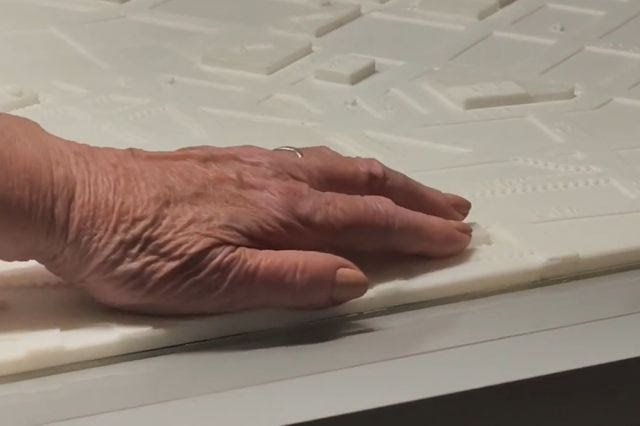
The new tactile map at Syntagma Metro station allows people with visual impairments to navigate independently around central Athens through touch, Braille and audio description.
- 18 Σεπτεμβρίου 2026 14:46
A model tactile map for people with visual impairments has been installed at Syntagma Metro station, offering users the ability to navigate independently around central Athens through touch.
The initiative was presented on Wednesday, September 16, also marking the start of European Mobility Week 2026.
How the tactile map at Syntagma works
The map has been installed on the station’s first underground level, at the beginning of the permanent archaeological exhibition, and covers the wider Omonia–Monastiraki–Syntagma area. It depicts key landmarks, buildings, squares, archaeological sites and Metro stations, using special tactile symbols designed according to shape, texture and height, as well as Braille.
To ensure full accessibility for all visitors, the installation also includes an explanatory map for sighted users, as well as a special QR code linking to an audio description. The project was designed by the City of Athens’ Geospatial Data Management Department, the Cartography Laboratory of the National Technical University of Athens, STASY S.A., the Accessibility & Inclusion Working Group and representatives of organisations for blind people, who actively participated in its testing.
Doukas: “It was designed together with the people who will use it”
Referring to the significance of the initiative, Athens Mayor Haris Doukas said: “This is a tactile map designed for citizens with visual impairments. By touching it, someone can understand where Omonia is, where City Hall is, where the Varvakios Market, Monastiraki and Syntagma are, while there is also an explanatory map for sighted people and a QR code with an audio description. Most importantly, it was designed together with the people who will use it. I would like to thank the Cartography Laboratory of the National Technical University of Athens, representatives of organisations for blind people, STASY S.A., as well as the Accessibility & Inclusion Working Group and all the City services that worked on the implementation of the project. Our goal is for the map to become a point of reference for universal accessibility, highlighting Athens as a model inclusive city.”
For his part, the Rector of the National Technical University of Athens, Ioannis Chatzigeorgiou, stressed: “Once again, the National Technical University of Athens is proving to be a pioneer in matters concerning the protection of vulnerable groups and contribution to society. Inclusion is in our DNA and in our blood. We are here to assist. I hope this initiative will be developed, enriched and expanded throughout the entire municipality. And we will always be here to help you.”
The priority of ensuring equal service for passengers was highlighted by the Chairman of STASY S.A. and CEO of OASA, Antonis Kerastaris: “Accessibility is a consistent priority for STASY and Athens Public Transport. In recent years, we have been working systematically to improve the travel experience of people with disabilities and reduced mobility. We are working towards a network that will be able to serve all passengers equally.”
A “thank you” from the community
Speaking on behalf of the community of people with visual impairments, former President of the Lighthouse for the Blind, Dimitra Asideri, said: “I would like to thank you, on behalf of the Blind Community and their companions, for this project, which will improve the lives of people with visual impairments. Together with the Mayor, we will continue with other programmes that will make our lives easier in the Athens we love.”
Finally, the City of Athens’ appointed Municipal Councillor for Accessibility, Elena Mantzavinou, noted: “We live together in this city — and the Tactile Map, which as of today is here at Syntagma Metro station, is an initiative that confirms this. We worked step by step, designing together and listening to their experiences. This map is not simply a tool — it is proof that when a city is designed together with its people, it truly becomes ours: all of ours, without exception.”