Weather: Conditions ease, but a new deterioration is on the way
Διαβάζεται σε 3'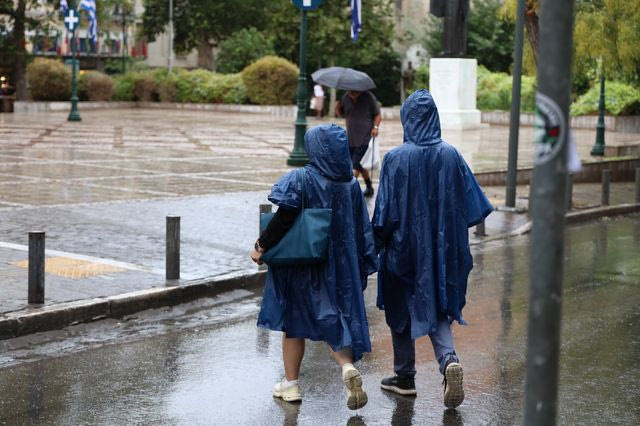
Rain and thunderstorms will continue today, Wednesday (23/9), in a limited part of the country. When is the next deterioration in the weather expected?
- 23 Σεπτεμβρίου 2026 12:57
Heavy rain and thunderstorms are expected again today, Wednesday (23/9), mainly in Halkidiki, the Sporades, Magnesia and Evia, while storms are also forecast in Crete.
Temperatures will remain low for the time of year, with highs reaching up to 26 degrees Celsius around midday.
From Thursday, the weather is expected to improve, with plenty of sunshine, although the cold will be noticeable during the night and early morning. In northern and mountainous areas, temperatures could even approach 0 degrees Celsius.
A new spell of unsettled weather with rain may arrive on Friday in western parts of the country, with updated forecasts expected in the coming days.
Sakis Arnaoutoglou’s forecast – What to expect as October begins
Meteorologist Sakis Arnaoutoglou is giving a similar outlook, noting that by midday on Wednesday, September 23, the instability will shift toward Crete.
In the rest of the country, the chances of heavy rain are expected to be very low. The same applies to Attica.
Cold northerly winds of 6 to 7 Beaufort will prevail in the Ionian and Aegean seas, while temperatures are expected to fall even further, with values possibly approaching 0°C in parts of central and northern Greece.
It is indicative that minimum temperatures of around 22 degrees Celsius, which were common during the summer, are now becoming daily highs.
On Thursday, September 24, the weather will be generally fine, but conditions are expected to change again from Friday morning, September 25. This will mainly affect western and northwestern Greece, where rain and thunderstorms are expected to be stronger, although “some rain bands will extend as far as western and central Macedonia.”
Rain is expected in the Peloponnese during the night of September 25 and across the eastern mainland on the morning of Saturday, September 26. In Attica, there is a chance of localized showers, although they are not expected to be significant.
Toward Sunday, September 27, rain is forecast in Evia, the Sporades and eastern Boeotia, while showers may also affect the eastern and northern parts of Attica on Sunday morning, September 28.
As for the broader weather trend, based on current forecast data, October appears likely to begin without rain, while temperatures could reach 27 to 28 degrees Celsius across lowland parts of the mainland.
Weather forecast from the Hellenic National Meteorological Service
Weather on Wednesday (23/09)
In eastern parts of the country and Crete, skies will be cloudy at times, with local rain and possibly isolated thunderstorms early in the morning, mainly over sea areas, followed by gradual improvement. Elsewhere, conditions will be mostly clear, with temporary cloud developing over the mainland around midday and in the afternoon.
Winds will blow from northerly directions at 4 to 6 Beaufort.
Temperatures will fall slightly further across the country.
Weather on Thursday (24/09)
The weather will be generally clear, with some temporary cloud over the mainland, mainly around midday and in the afternoon.
Winds will blow from northerly directions at 3 to 5 Beaufort, reaching 6 Beaufort locally in the Aegean.
Temperatures will remain largely unchanged.