The cold front begins, with temperature drop across the country – Where it will snow
Διαβάζεται σε 9'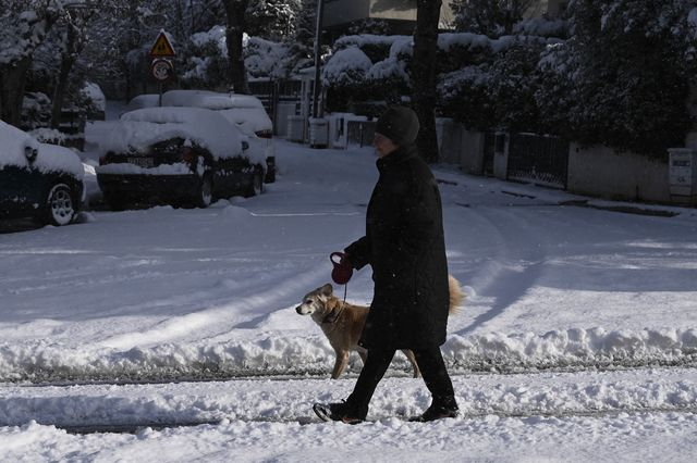
The weather is deteriorating again from today, with even lower temperatures and snowfall expected. An in-depth weather forecast.
- 17 Ιανουαρίου 2026 12:45
The weather is becoming more winter-like, with new low temperatures and snow expected in some areas.
Starting today, Saturday (January 17), the cold front begins, which will affect the country with rain and snow over the next 24 hours.
As meteorologist Thodoris Kolyvdas mentions:
“Temperature DROP from Saturday, which will be noticeable across the country on Sunday and Monday – LOCAL RAIN and generally WEAK SNOWFALLS in mountainous areas, as well as in semi-mountainous regions of central and northern Greece. Cold air masses from northeastern Europe are expected to significantly change the weather, with the shift beginning on Saturday, January 17, and becoming more noticeable on Sunday and Monday. The forecast is as follows:
- Noticeable drop in temperature, which will reach 7 to 8 degrees Celsius lower than today’s values.
- Local rains, mainly in the eastern and southern mainland parts of the country, as well as Crete.
- Local snowfalls, generally weak: in the mountains, semi-mountainous areas of central Greece, as well as northern Thessaly, Macedonia, and Thrace, even at lower altitudes.
- Wind strength will increase, with northeastern winds in the Aegean reaching 7–8 Beaufort, and eastern winds in the Ionian reaching up to 6–7 Beaufort. The phenomena will last until the evening of Monday, January 19, with local variations in intensity and distribution.”
Forecast for Saturday, January 17, 2026
Today, in Macedonia, Thrace, and possibly briefly in the northern Aegean islands, there will be increased cloud cover with local rain or sleet.
In eastern Thessaly, the Sporades, Euboea, eastern Sterea, eastern Peloponnese, the Cyclades, Crete, and the Ionian islands (from Kefalonia southward), there will be partly increased cloud cover with local rain, and possibly isolated thunderstorms in the southern Ionian, the western Peloponnese, and southern Crete, mainly over the sea. In the rest of the country, there will be a few clouds briefly increased, with a chance of weak local rain in the western Peloponnese. Weak snowfall will occur in the mountainous areas of the mainland, as well as in semi-mountainous regions of central and northern Greece.
Winds will blow from eastern directions at 4 to 6 Beaufort in the west, with up to 7, locally 8 Beaufort in the southern Ionian. In the east, they will be northeasterly, blowing at 5 to 6 Beaufort, and in the Aegean at 7 Beaufort.
Temperatures will drop, mainly in the maximum values. In the northern mainland, temperatures will range from 06 to 08 degrees Celsius, in the rest of the mainland from 08 to 13, in the west up to 15–16, and in the island areas from 16 to 17 degrees Celsius. Frost will occur in the morning and evening hours in the central and northern mainland.
Macedonia, Thrace
Weather: Increased cloud cover with local rain or sleet, mainly in central and western Macedonia. Weak snowfall will occur briefly in the mountains, as well as in semi-mountainous regions of central and eastern Macedonia and Thrace.
Winds: Easterly northeasterly at 4 to 6 Beaufort, and up to 7 Beaufort in the sea.
Temperature: From -02 to 08 degrees Celsius.
Ionian Islands, Epirus, Western Sterea, Western Peloponnese
Weather: Cloudy with temporary rain and possibly isolated thunderstorms in the Ionian (from Kefalonia southward) and the western Peloponnese, mainly in the sea. From midday, the weather will gradually become generally clear from the north.
Weak snowfall will occur in the mountainous areas of Epirus.
Winds: Easterly directions at 4 to 5 Beaufort, locally 6, and in the southern sea up to 7, locally 8 Beaufort.
Temperature: From 04 to 14–15 degrees Celsius. In Epirus, 4–6 degrees lower.
Thessaly, Eastern Sterea, Euboea, Eastern Peloponnese
Weather: Increased cloud cover with local rain. Snowfall will occur in the mountains of Thessaly, eastern Sterea, and eastern Peloponnese, as well as in semi-mountainous areas of Thessaly.
Winds: Easterly northeasterly at 4 to 6 Beaufort, 7 Beaufort in the east, and 8 Beaufort locally in the southern sea.
Temperature: From 02 to 13, locally 14 degrees Celsius in the south. In the north, 3 to 4 degrees lower.
Cyclades, Crete
Weather: In the Cyclades, there will be a few clouds, briefly increased with local rain until midday. In Crete, there will be increased cloud cover with local rain and possibly isolated thunderstorms in the south. In the evening, light snow is possible in the mountains.
Winds: Northeasterly at 4 to 5 Beaufort, increasing to 5 to 7 Beaufort. In Crete, initially variable, weak, becoming northeasterly at 4 to 6 and up to 7 Beaufort in the east and south.
Temperature: From 08 to 16–17 degrees Celsius.
Dodecanese, Eastern Aegean Islands
Weather: In the eastern Aegean islands, there will be a few clouds, becoming generally clear after midday. In the Dodecanese, there will be intermittent clouds, denser at times.
Winds: Northeasterly at 4 to 6 Beaufort, locally up to 7 in the north, and north-northwest at 3 to 4 Beaufort, increasing to 4 to 6 Beaufort in the south.
Temperature: From 11 to 16–17 degrees Celsius. In the north, 3 to 4 degrees lower.
Attica
Weather: Clouds will increase briefly until midday, with a chance of weak local rain in the east and north.
Winds: Northeasterly at 4 to 6, up to 7 Beaufort in the east.
Temperature: From 05 to 12–13 degrees Celsius.
Thessaloniki
Weather: Increased cloud cover with a few local rain showers, weak snowfall in the mountains, and improvement from midday.
Winds: Easterly at 3 to 5 Beaufort, locally up to 7 in the south, gradually weakening.
Temperature: From 03 to 08 degrees Celsius.
Forecast for Sunday, January 18, 2026
In western and central Macedonia, Thessaly, the northern Aegean islands, Euboea, eastern Sterea, and eastern Peloponnese, there will be increased cloud cover with local rain or sleet and weak snowfall in the mountains, in western, central Macedonia, and Thessaly, as well as in semi-mountainous areas. In the rest of the country, there will be a few clouds, briefly increased, with a few local rain showers in the Cyclades, Crete, and briefly in the Dodecanese, and weak snow in the mountains of Crete.
Winds will blow from eastern directions in the west at 4 to 6 Beaufort, from northern directions in the east at 5 to 7 Beaufort, and in the southern Aegean, locally up to 8 Beaufort.
Temperatures will drop slightly, mainly in the maximum values. In the northern mainland, temperatures will not exceed 04 to 06 degrees, in the rest of the mainland and the Ionian islands, it will range from 07 to 12 degrees, and locally in western mainland and the Cyclades, it will be between 13 and 14 degrees. Only in southern Crete and the Dodecanese will temperatures reach 15 to 16 degrees Celsius. Frost will occur in the morning and evening hours in the mainland, and in the northeastern areas, it will be locally intense.
Forecast for Monday, January 19, 2026
In western and central Macedonia, Thessaly, the northern Aegean islands, Euboea, eastern Sterea, and eastern Peloponnese, there will be increased cloud cover with local rain or sleet and snowfall in the mountains, as well as in semi-mountainous areas of western and central Macedonia, Thessaly, and central Sterea.
In the rest of the country, there will be a few clouds, briefly increased, with a few local rain showers in the Cyclades, Crete, and the Dodecanese, and weak snowfall in the mountains of Crete. Winds will blow from eastern directions in the west, and from northern directions in the east at 5 to 7 Beaufort, and in the Aegean, locally up to 8 Beaufort, with a trend to intensify at night.
Temperatures will not change significantly. Frost will occur in the morning and evening hours in the mainland, and in the northern areas, it will be locally intense.
Forecast for Tuesday, January 20, 2026
In the southern parts of central Macedonia, Thessaly, the northern Aegean islands, Euboea, eastern Sterea, the Peloponnese, southern Ionian, the Cyclades, Crete, and the Dodecanese, there will be increased cloud cover with local rain mainly in the south and sleet in the north. Snowfall will occur in the mountainous – semi-mountainous areas, as well as in the mountains of Euboea and Crete. In the rest of the country, there will be a few clouds, briefly increased. Winds will blow from the northeast in the west at 6 to 8 Beaufort, in the southwestern areas, locally up to 9 Beaufort, and in the east, 5 to 7 Beaufort.
Temperatures will rise slightly, mainly in the southeastern parts. Frost will occur in the morning and evening hours in the mainland, and in the northern areas, it will be locally intense.
Forecast for Wednesday, January 21, 2026
The weather will worsen, with increased cloud cover and local rain across most of the country. Sporadic thunderstorms will occur mainly in the sea – coastal areas of central and southern Greece. Snowfall will occur in the mountainous – semi-mountainous areas, and it is expected to be more intense in the central and northern parts.
Winds will blow from the east-southeast in the west at 6 to 8 Beaufort, and in the early morning, locally up to 9 Beaufort, gradually weakening. In the east, winds will be from the northeast at 5 to 7 Beaufort, and in the south, from the southeast at 6 to 8 Beaufort.
Temperatures will rise further across most of the country, but frost will still occur in the morning and evening hours in the northern mainland.