Greece weather: Rain, thunderstorms and cooler temperatures ahead
Διαβάζεται σε 4'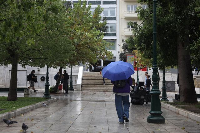
Unsettled weather is expected across Greece over the coming days, with scattered showers and thunderstorms followed by a gradual rise in temperatures. Winds could reach 7 Beaufort in the Aegean by Wednesday.
- 15 Νοεμβρίου 2026 10:27
Rain, isolated thunderstorms and a slight drop in temperatures, particularly in northern Greece, are expected on Sunday (November 15), according to the Hellenic National Meteorological Service (EMY).
The unsettled conditions will mainly affect eastern and northern parts of the country, while rain and possible thunderstorms are forecast to develop in western Greece during the evening.
Weather conditions are expected to gradually improve over the following days, although scattered showers will persist in some areas. Temperatures are forecast to rise slightly from Tuesday.
Meanwhile, winds will strengthen again on Wednesday, reaching up to 7 Beaufort in parts of the Aegean Sea.
Greece weather forecast: What to expect over the coming days
Sunday, November 15
Eastern and northern Greece will experience intermittent cloud cover with local showers, while isolated thunderstorms are possible in the northeast during the morning and in the northern Ionian Sea, Epirus and western Central Greece during the evening.
Elsewhere, temporary cloud cover is expected, mainly over mainland areas in the afternoon, with a few scattered showers.
Visibility will be locally reduced in western Greece during the morning.
Winds in the Ionian Sea will blow from southerly directions at 3–4 Beaufort, gradually reaching 5 Beaufort in some areas. In the Aegean, northerly winds will reach 4–5 Beaufort, locally 6 Beaufort during the morning.
Temperatures will fall slightly, particularly in northern Greece, where highs will range from 15°C to 17°C. Elsewhere, temperatures will reach 18°C to 22°C, locally climbing to 23–24°C.
Temperatures by region (minimum – maximum):
- Thrace: 10–16°C
- Eastern Macedonia: 11–15°C
- Central Macedonia: 11–17°C
- Western Macedonia: 9–15°C
- Epirus: 11–18°C
- Thessaly: 12–18°C
- Ionian Islands: 15–21°C
- Western Central Greece: 13–22°C
- Western Peloponnese: 12–22°C
- Eastern Peloponnese: 14–22°C
- Cyclades: 17–23°C
- Eastern Central Greece and Evia: 15–21°C
- Crete: 16–24°C
- Eastern Aegean Islands: 15–23°C
- Dodecanese: 18–24°C
- Attica (Athens): 15–21°C
- Thessaloniki: 12–16°C
Monday, November 16
Western and northern Greece will see periods of increased cloud cover and scattered showers, mainly in western areas, where isolated thunderstorms may also develop.
The rest of the country will experience generally fair weather, with occasional thin clouds becoming denser at times.
Visibility will be locally reduced during the morning and evening hours.
Winds will blow from southerly directions at 3–5 Beaufort. In the southeastern Aegean, north to northwesterly winds of similar strength are expected.
Temperatures will remain largely unchanged, reaching 16–18°C across the northern mainland and 19–23°C elsewhere.
Tuesday, November 17
Partly cloudy conditions are forecast, with scattered showers in western Greece and the eastern Aegean.
Isolated thunderstorms may occur during the morning, followed by an improvement in conditions from the afternoon onwards.
Visibility will be locally reduced during the morning and evening.
Winds will blow from westerly directions at 3–5 Beaufort, temporarily reaching 6 Beaufort in parts of the southern Aegean.
Temperatures will rise slightly across the country.
Wednesday, November 18
Thin cloud cover is expected, becoming denser at times across western and northern Greece and the eastern Aegean, where light local showers are forecast.
West to southwesterly winds will strengthen to 4–6 Beaufort, reaching 7 Beaufort locally in the Aegean Sea.
Temperatures are expected to increase slightly further, continuing the gradual warming trend.